Panoramic views. A journey through the cities of the world
Keywords:
geography, maps, cities, art, historySynopsis
There was a time when travel books were written by poets, fantastical stories were told by storytellers, and maps were painted by artists. That was the Golden Age of maps: between the Casa de la Contratación in Seville and Ortelius's atlas in Antwerp. Marvelous legends gave way to geographical certainties. Cartographers, besides guarding state secrets, managed to create a seductive beauty in their works of art. The iridescent poetry of maps had just been born.
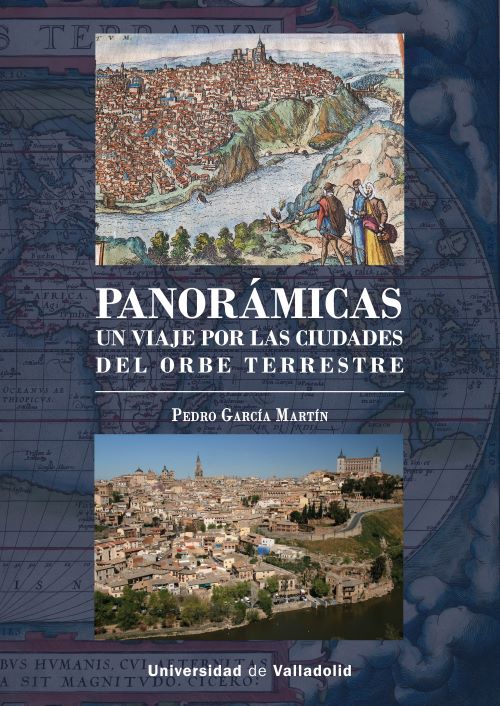
The discoveries of the New World awakened the Iberian dream of "Plus Ultra!" Global trade and the Enlightenment aesthetic fueled the market for world maps among the cultured elites of Europe. In that fascinating climate, the German Georg Braun formed a team to undertake the publishing project of Civitates Orbis Terrarum. Six volumes of cityscapes from around the world, published between 1572 and 1617, would become the most famous collection of urban views and portraits of their people in history.
Five hundred years later, we write these humble Panoramas, offering a modern perspective on the cities of the terrestrial and even celestial world. They are preceded by the memory of panoramas as a visual spectacle, the shift from a frontal to a vertical perception of the landscape, and an invitation to journey beyond! To this end, we have selected 38 cities following the criteria of Civitates, updating our view of their skylines and comparing their evolution through the ravages of time. This alliance between text and photographs allows us to appreciate the finest aspects of each skyline: from Madrid, the sky; from Florence, an artists' paradise; from Athens, the beauty of knowledge; from Tokyo, cherry blossoms; from Calcutta, the pride of poverty; from Cairo, the miracle of the Nile; from Cusco, a hymn to joy; From Antarctica, whispers of ice, and so on.
Ultimately, this book, with its loving prologue, is a beacon of multicolored lights from which to gaze out onto the balcony of the world, a gallery of words and vistas to revel in cheerful colors and delicate fragrances. Even if it is only a blue dot from a lookout point orbiting through space.
References
PADRÓN, Ricardo, en The Spacious Word (2004), hizo confluir ciencia, literatura y poder en el estudio de la cartografía de los Imperios descubridores del siglo XVI.
David BUISSERET, en varios libros sobre mapas modernos, demostró que en el Renacimiento se dio una revolución espacial. El poder patrocinó los mapas y éstos le ayudaron a conocer sus dominios.
BARBER, Peter, en El Gran Libro de los Mapas (2005), recopiló ejemplares de distinta época en los que destacó sus valores ilustrativos. Los mapas son obras de arte.
VIRGA, Vincent, en su Cartographia (2007), comparó las etapas de la infancia con la historia de la cartografía. Desde los mapas simples como los dibujos de los niños hasta el “realismo” de las pinturas adultas.
BRENDECKE, Arnd, en Imperio e información (2012), estudió las técnicas de recogida de información y la imagen de Felipe II como una “araña que se mueve desde el centro de la tela del Imperio”.
PORTUONDO, María, en Ciencia secreta (2013), se centró en la cosmografía, esto es, la suma de disciplinas que ayudó a conocer los pueblos y gentes del Nuevo Mundo.
Exposiciones como Cartografías de lo desconocido en la Biblioteca Nacional de Madrid (2017), Fuimos los primeros. Magallanes, Elcano y la vuelta al mundo en el Museo Naval de Madrid (2019) y la colección Mapas del Mundo de El País que acaba de editarse, han dado cuenta de estas novedades en la consideración de los mapas.
GARCÍA REDONDO, José María, en Cartografía e Imperio (2018), estudió el Padrón Real como un conjunto de documentos textuales y visuales que sirvieron para fijar las rutas marítimas entre España y las Indias.
Y el gran especialista en cartografía, SÁNCHEZ, Antonio, en La espada, la cruz y el Padrón (2013) sostiene que en el apogeo del Imperio hispánico los mapas tenían dos valores: uno utilitario, pues las cartas de marear facilitaban la navegación de los pilotos, y otro iconográfico, dado reflejaban la imagen de la monarquía de los Austrias como poder global.
Price
17,31 EURPublished
Categories
Right Holder
Ediciones Universidad de Valladolid y autor(es)/autora(s) 2026License

This work is licensed under a Creative Commons Attribution-NonCommercial-NoDerivatives 4.0 International License.